Why Rivers Make Natural Edges on a County Map
Why rivers make natural edges on a county map: learn when a river is a useful boundary clue and when to check the official administrative line.
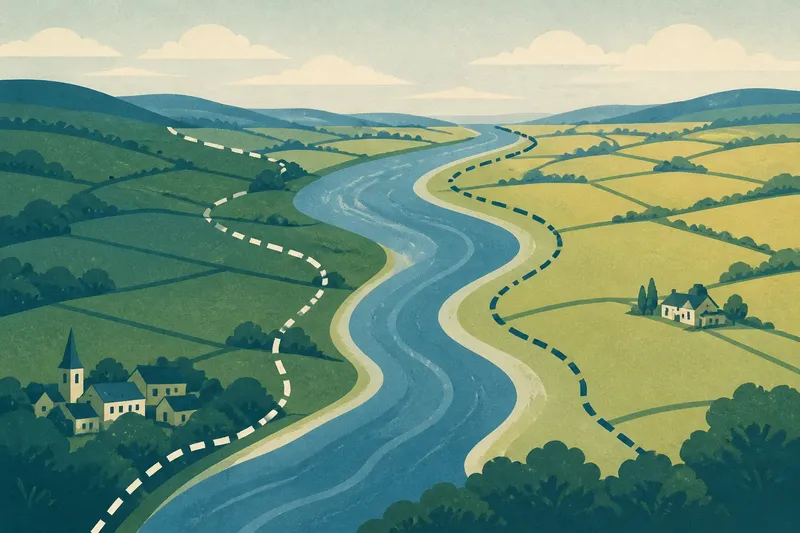
Why rivers make natural edges on a county map is a question that often begins with a bend in the water and a line on paper. If a county boundary seems to follow a river, the channel can make the border easier to see—but it does not, by itself, tell you where the administrative line runs.
The useful distinction is between a river as a physical feature and a river as a chosen boundary. Which matters most depends on what you are trying to understand: the landscape, the location of a county limit, or a change in local administration.
Start with your purpose
For a broad sense of county geography, a river is a strong visual clue. Its valley may form a natural division between areas, and the watercourse gives the eye a continuous feature to follow across a map. This works particularly well on a county overview map, where small legal details are not the point.
If you need to establish which county a particular building, parcel or stretch of bank belongs to, treat the river as a lead, not an answer. Check the relevant official boundary map or mapping service. The county line may follow the channel, one bank, a surveyed course or a separate line across the valley.
For a local history question, keep both possibilities open. A river may have shaped movement and settlement without ever being adopted as the formal county limit. Conversely, an administrative boundary may have been drawn along a river for convenience even where the water did not separate communities in everyday life.
Read the river’s shape
On a map, look first at whether the county line follows the river continuously. A close match over a long reach is more suggestive than a short crossing or a line that merely touches the bank. Notice bridges, tributaries and bends: these features help you compare the boundary with the watercourse, but they cannot settle a legal question on their own.
Also ask which part of the river the map depicts. A narrow blue line may stand for a channel, while a wider mark can show a water surface or flood-prone ground. A boundary drawn through the channel could be represented differently from one assigned to either bank. At the scale of a small map, those distinctions may disappear.
Rivers also shift. A meander can erode one bank and build up another, while a channel may be altered or diverted. The visible water today may therefore differ from the feature used when a boundary was established. That is one reason a natural-looking edge should not be mistaken for a precise administrative description.
Choose the right map
- For an overview: use a county map that shows rivers and boundary lines together. It is suited to seeing broad patterns, not locating a parcel.
- For a specific address: use an official county boundary map or a recognised local authority mapping service. Compare the address with the boundary layer rather than estimating from a general road atlas.
- For a property or land question: consult the relevant authoritative records and seek qualified advice if rights or responsibilities depend on the exact line.
- For historical interpretation: compare maps from different periods, noting their dates, scale and purpose. A map made for navigation, landholding or administration may show features differently.
- For a walk or visit: use the river as a landscape guide, then check access information separately. A county boundary does not indicate a public route or permission to cross land.
Map labels matter, too. A line may mark a county, district, parish or another administrative area. Similar-looking symbols can represent different things, so check the legend and the map’s stated purpose before drawing conclusions. Where an exact location or responsibility matters, the relevant authority’s current mapping and records take precedence over a general map; for legal or property implications, ask a qualified professional.
What are you trying to locate?
Does the county line always follow the river?
No. It may follow the channel for part of its course, leave it, or cross the river elsewhere. The map’s boundary layer, rather than the water alone, shows the administrative line.
Which bank belongs to which county?
You cannot reliably tell from the colour of the water or the nearest label. Check a detailed official map, especially where the boundary could run along a bank instead of through the channel.
Can a river change the boundary?
A shifting channel can make the visible landscape and mapped boundary harder to match. Whether the administrative line changes with the water depends on the way that boundary is defined, so do not infer the answer from a newer-looking river course.
Why use a river as a boundary?
A river is often a continuous, recognisable feature that can be described and followed on the ground. That makes it legible, though it does not mean the river separates neighbouring communities or jurisdictions in every practical sense.
Sort by situation
Say you are comparing two counties on a regional map and notice a blue river running beside their shared edge. If your aim is to understand the broad geography, follow the river as a helpful visual guide; the expected result is a clearer sense of how the counties meet in the landscape. If you then need to identify the county of a riverside house, switch to the official boundary map and check the precise location instead.
That change of method is the heart of the decision. A river fits a landscape reading because it is visible and continuous. An administrative map fits a jurisdiction question because it records the boundary being represented. For a historical account, compare both and describe what each can support, rather than treating one as proof of the other.
Skip false precision
It is not worth tracing a county line from a tiny printed map, a satellite image or a river’s apparent centre and then treating the result as exact. Those views are useful for orientation, but their scale and symbols can conceal the distinction between bank, channel and boundary.
Why rivers make natural edges on a county map is ultimately about legibility, not certainty. Let the river explain the shape of a place; let the appropriate administrative record answer where the formal line lies. Keeping those two questions separate makes a map easier to read—and keeps a plausible visual clue from carrying more weight than it can bear.